
Plnar Pro
Seamless claims documentation, from photos to settlement.
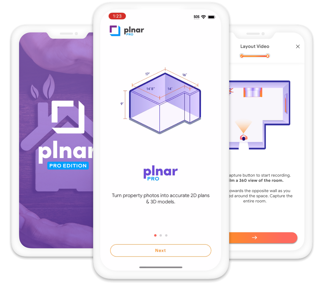
Plnar Pro turns smartphone imagery into precise measurements, floor plans, 3D models, and estimate-ready exports. Built for field professionals handling claims and inspections, inside and out.
30-day free trial. Download on the App Store
- #1
- In claim 3D modeling
- Top 100
- Carriers trust Plnar
- 98%
- Unmatched precision
Capture
Smartphone photos, made smart.
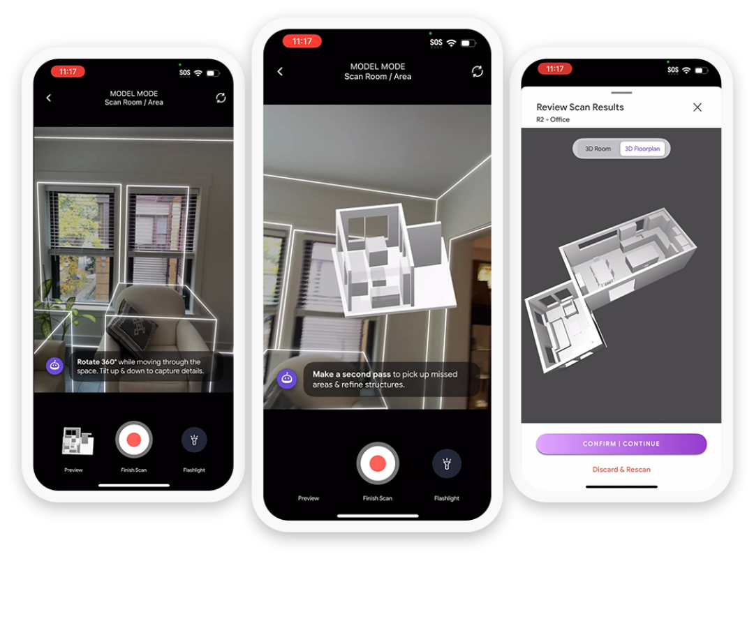
No extra hardware. Capture a room or property with the phone already in your pocket, then pick the capture method that fits the job.

Instant LiDAR-Sketch Capture
On a LiDAR-equipped iPhone or iPad, the sketch and model are ready instantly, so you can start the estimate on site.

Photo-Based Capture
Works on any supported smartphone. Models are quality-inspected and delivered within 24 hours.

SnapShot photo documentation
Guided photos, a report, and shareable documentation for claims, inspections, and supplemental evidence.
How it works
One workflow, from the field to the estimate.
Plnar Pro connects capture, measurement, and estimating so documentation stays consistent from the first photo to settlement.
- 01
Capture
Guided smartphone capture of interiors and exteriors, with LiDAR or photos.
- 02
Understand
AI builds floor plans and 3D models, identifying openings and room features like cabinetry.
- 03
Scope
Measure surface area, volume, and perimeter from measure-ready imagery, with tags and notes on damage.
- 04
Estimate
Send sketches into Xactimate or Cotality Estimate, with ESX and FML file outputs.
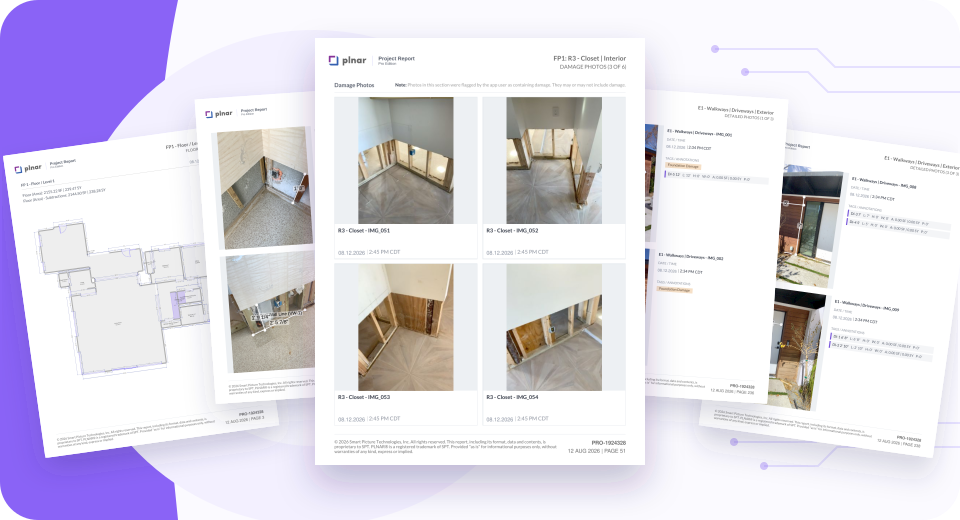
Estimate-ready outputs from every project
- 3D model and interior floor plans
- Professional Measurement Report
- Xactimate and Cotality exports
- Measure anything later, with no return visit
For every role
Instant photos, 3D models, and estimates for every step of the claim.
One platform serves the people in the field and the teams that manage the claim.
For field professionals
Document the loss once, completely.
-
Capture measure-ready photos
Guided smartphone capture, with LiDAR or photos.
-
Generate 3D models quickly
Floor plans and models built from the capture, not by hand.
-
Enable remote assessments
Measure and review later, without a return trip.
Key benefits
- Fewer site visits
- Faster estimates
- Accurate results
For insurance carriers
Move more claims with less friction.
-
Easy-to-use tools for adjusters
Consistent documentation across staff and field teams.
-
Self-service options for homeowners
Policyholders can capture their own space.
-
Simplify claims processing
Estimate-ready outputs flow into existing workflows.
Key benefits
- Lower costs
- Happier policyholders
- More claims handled efficiently
Why Plnar
Why field professionals choose Plnar.
Smarter fieldwork, made easy.

Save time
Document claims in minutes with your smartphone.

Work anywhere
Process claims remotely, with no site visit needed.
Ensure accuracy
AI-powered models reduce costly errors.
Streamline processes
One platform for consistent documentation.


Scale effortlessly
Tools that grow with your business.
Trusted Across the Industry
Plnar Integrates Seamlessly with Your Workflow








Plnar works as hard as you do.
Precision, simplicity, and savings in every claim. Start a 30-day free trial or see Plnar Pro with our team.